
New guides for exploring Reading on foot
- Four Wellbeing Walk route maps highlight interesting features and fascinating facts about places around the borough
- Updated walking maps and leaflets are also available on the refreshed Walking webpage
A series of four guides have been produced to encourage residents and visitors to walk around Reading and enjoy its parks, rivers and green spaces, as well as discover the town’s rich history.
A Walking page on the Council’s website has also been refreshed and includes walks in central Reading, nature walks and updated interactive walking network maps and links to other resources.
Walking can provide a number of benefits, including improved physical and mental health, reduce stress and improve mood and can be a fun and free way to enjoy your local area.
All walks are circular and start and finish in the town centre but can also be picked up along the route.
The four Wellbeing Walk guides feature:
- Thames and Kennet – an easy-going 5km walk taking in the two rivers with plenty of scenery and wildlife.
- Kennet and Southcote – 9km circular walk along the Kennet and Avon Canal across Southcote meadows and back to the town centre via Prospect Park and west Reading.
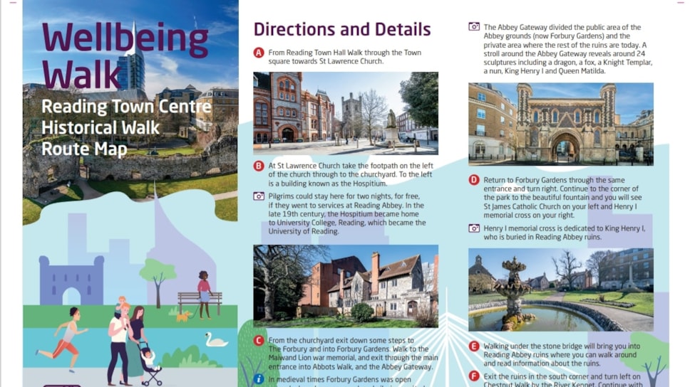
- Town centre – 3km circular walk from Reading Town Hall taking in some of the many historic and interesting places within Reading.
- Caversham – 9.5km circular walk from the north side of Reading Station through Caversham and Caversham Heights back to Reading station, via St Peter’s Churchyard and Caversham Court.
Each Wellbeing Walk map contains information about places of interest and fascinating historical facts. There is also advice about the walk’s level of difficulty and accessibility.
The maps are available from Reading Town Hall and Reading Libraries or can be downloaded from the Council website at: https://www.reading.gov.uk/vehicles-roads-and-transport/walking/.
The webpage also features ideas for nature walks, including Clayfield Copse, Prospect Park and Fobney Island Nature Reserve, and walks in central Reading.
There are also details of walking groups and campaigns, updated interactive walking maps to plan your journey and a section on the benefits of walking. The site also features related Council strategies including the Local Cycling and Walking Infrastructure Plan.
Cllr John Ennis, Lead Councillor for Climate Strategy and Transport, said:
“The Wellbeing Walk maps are ideal for exploring parts of Reading you may not be familiar with while getting some fresh air and exercise. They are also great for finding out more about places in Reading that you already know.
“The updated Council webpage also has plenty of suggestions for other walks around the borough as well as information about walking groups and the benefits of walking.
“I would recommend downloading, or picking up, copies of the Wellbeing Walk maps and heading out, as you notice so much more about the borough than you would normally when you are rushing from one place to another.”