Council Public Rights of Way Consultation Could Consider Access to Footpaths on Caversham Park Estate
- Residents urged to help improve Reading’s Public Rights of Way
- The consultation also considers historic Rights of Way that have been lost
READING Borough Council is encouraging residents to have their say on how they currently use Reading’s Public Rights of Way Network, in a bid to provide a better experience for its users and encourage active travel.
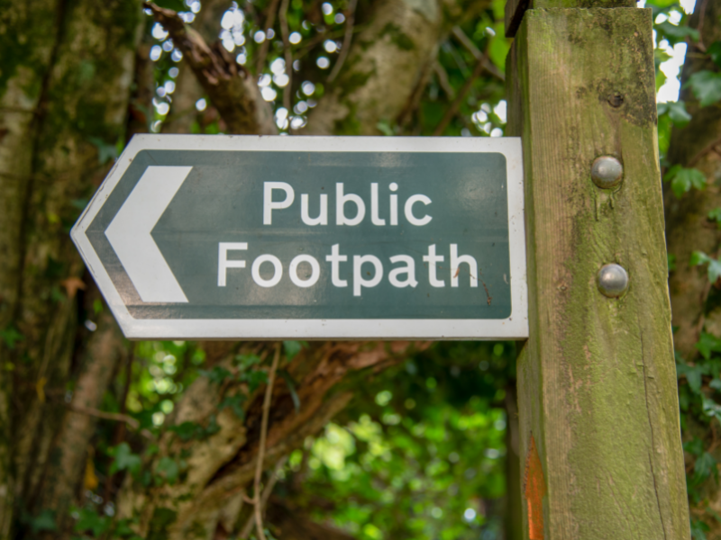
The Council manages 21 miles of public Rights of Way across the borough, which provide vital connections for many people to access open space and are often used by residents when travelling to work and school. It is important that the Council protects, maintains and enhances Rights of Way across the Borough. This network supports our ambitions to encourage active travel (e.g. cycling and walking) and as a result support better physical and mental health, lower carbon generation and improved air quality.
Residents are invited to have their say on how they currently use Reading’s Public Rights of Way Network, to highlight any barriers or issues to increased use of the network, and suggest what could be done to enhance the network – for example, make it more accessible to all users, better maintained or signposted. This will allow the Council to update its Public Rights of Way Improvement Plan – a sub-strategy of Reading’s Local Transport Plan.
As part of the consultation, people are also being encouraged to report any historic Rights of Way that may be missing from the current network. This could include, for example, access to the private parkland within the former BBC Monitoring Site at Caversham Park, which is currently on the market and off-limits to the public, but some local residents claim the area once included public footpaths.
Tony Page, Reading Borough Council’s Lead Councillor for Strategic Environment, Planning and Transport, said: “I’d like to encourage everyone to have a say on our Public Rights of Way consultation. You may not have even heard of this network – but you may be using it every day! It is vital we look after it and we really need your input and insights to achieve this.”
“Over the last year, these local routes have been used much more during the lockdown periods, where people explored their local areas. Increased walking around our local areas has been beneficial to our health and mental wellbeing.
“Please help us protect, maintain and enhance the Rights of Way across our borough. Many of the footpaths are key routes connecting people to destinations such as the town centre, Reading Station, Green Park and Thames Valley Business Park. They are used by people travelling to work and school, as well as many rural-type routes that are used for leisure.
“We want to know how people are using this network and what we can do to help people use it more. We’d like to better integrate these routes into Reading’s overall transport network - to provide a better experience, and to encourage more people to choose to walk or cycle for local journeys. It is also part of our wider, long term transport vision to encourage more people to active travel, by enhancing walking and cycling routes across our town.”
“We also want to know about any historic Rights of Way that are not included in the current network list. A topical example of this is the land on the Caversham Park Estate in Emmer Green.”
“We know there is a lot of local support for providing public access to this beautiful parkland. We have heard that employees, who worked at the former BBC monitoring station, thought previous footpaths they remember using across the site had now disappeared. Whether they are registered Rights of Way is unclear but I invite anyone who used to work there, or local residents, to submit evidence of paths that went across the site so we can do further research on the status of those footpaths as part of this consultation. We have until 2026 to include historic footpaths in our network, after which time they will be lost permanently.”
Reading’s Public Rights of Way consultation launches for seven weeks on Monday 7 June and will close on Thursday 24 July 2021.
To take part online visit: www.reading.gov.uk/RightsofWay
For further information or to request alternative formats contact: transport@reading.gov.uk
Notes to editors
The Council is due to review and update its Public Rights of Way Improvement Plan in order to ensure the network is kept up-to-date. The aim of the plan is to ensure the network is well maintained, supported with information for the public, inclusive and can be used by all also those with restricted mobility, better connected with the overall transport network (e.g. walking and cycling) and to key destinations. The aim is also to encourage more people to walk and cycle in their local area.
Public Rights of Way are rights across land accessible by the public, which allow people to pass along them at any time they choose – even if the land is privately owned. This includes footpaths, bridleways – which are also open to horse riders and cyclists, restricted byways (for any transport without a motor – except for powered wheelchairs or mobility scooters) and byways that are open to all traffic.
The Council manages the Public Rights of Way Network in Reading, which covers 41 footpaths, three bridleways and one restricted byway. As a highway authority, the Council has a duty to hold the Rights of Way definitive map and statement, and to keep routes adequately maintained, free from obstruction and signposted.